Watertribe North Carolina Challenge 2015 100 mile Ultra Marathon
10/15/15 2100 Well, I did better on triaging the gear. Including water the kit weighed in at 45lbs.
Every entrant in the Watertribe events goes by a Handle. Mine has been SeaDawg. Silly maybe but it is what it is.
The event this year had moved to a different start/finish spot, the Don Lee Retreat Camp on the north bank of the Nuese River. The river is 4 miles across at this point and broadens out from there before it empties out into the Pamlico Sound. This start point gets the participants into one of the two skinny waterways that were mandatory parts of the course, the Harlow Canal and later Thorofare Canal.
This being a bit later in the year than previous years, participation seemed lighter with definitely a greater concentration of sail craft vs. kayaks/paddle craft.
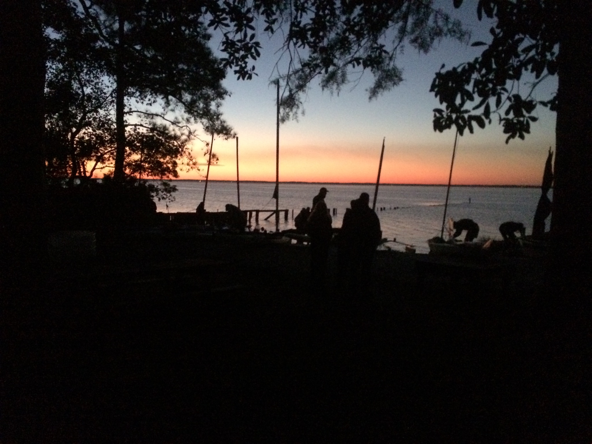
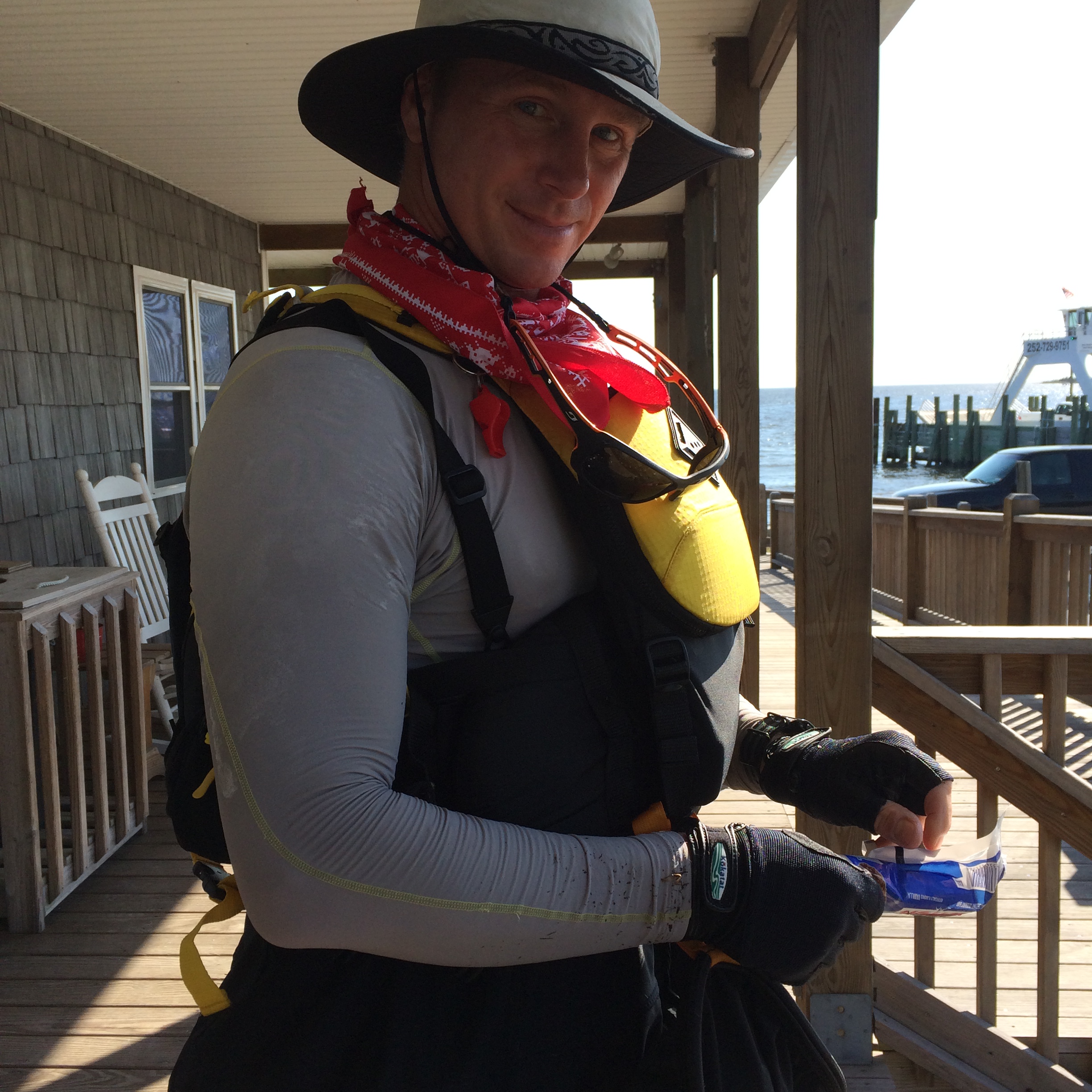
Participants Pre-Sunrise Prep

NCC100 Participants
The Start – Nuese River Crossing
From Don Lee ther was barely any wind to be had so paddle and pedal drive was definitely an advantage. As I was a bit excited about the start of this adventure I fell in behind another kayaker, MosquitoMagnet. What I realized after a mile was that he was heading too far eastward from the mouth of Clubfoot Creek. As there weren’t Mosquitos on the Nuesse the Magnet seemed to attract a huge flock of seagulls. Go figure.
Getting back on track I joined BermudaBoy on his sail board which he had just enough wind to make 4mph so we cruised along well enough until the wind kicked up and BB powered on ahead. Once in the mouth of the creek the wind completely disappeared and the water glassy except for MM residual wake ripples from his paddle pace about a half mile ahead of me.
Harlow Canal Entrance
Approaching the first bridge I noticed a bit of current pushing against me. On the bridge, my cheering section, my wife Dorothy, with a “Go Marshall!” cheer.
The further into the Harlow Canal the more the current was prevalent. No problem, I says to myself. When I get to midpoint the current will start to flow in my favor. Wrong, thinking. The push against me continued the entire time. At least the additional effort was early in the course. Anyone on sail power as primary propulsion was less than pleased with the current in the Harlow.
Once clear of the Harlow the reach across the Newport River to Beaufort was with increasing SW winds, a bit of chop and easy paddling making for a steady pace to the marsh areas on the to the west of the airport. It takes a bit of continuous effort to hold the kayak against the sail pressure from beam or quartering winds. This would catch up with me later.
I was a little too south in my heading which worked great as I found a channel through the marshes that lots of fishermen were anchored in fishing for Spot. I wasn’t familiar with this fish but apparently a tasty small fish that is very popular with recreational anglers as I discovered in Taylor Creek coming into downtown Beaufort as the approach was absolutely choked with all manner of runabouts and fishing kayaks. Made for a bit of dodge-kayak as I threaded the needle between fishing/anchor lines and craft.
Sticking close to the docked ships and boats I continued under paddle and sail to the old CP1 on the Beaufort waterfront. There I met my wife there who kept me company during lunch. BTW National Parks building across street open most hours with public restrooms = good thing.
After a dose of well wishes and some food in me I pushed off to continue down Taylor’s Creek and passing Carrot Island I was treated to a herd of wild ponies grazing in the shallows. They couldn’t be bothered with acknowledging my being there. They’re well adapted to tourist gawkers.
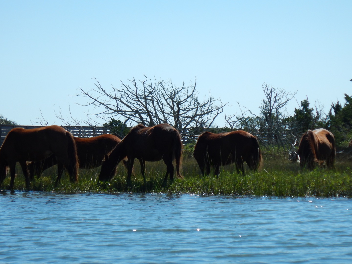
Wild Horses of Carrot Island, Beaufort, NC
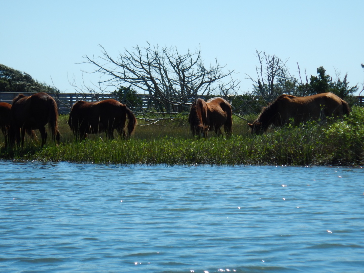
Wild Horses of Carrot Island, Beaufort, NC
The tail winds kept up passing the grassy flats between Beaufort and Harkers Island and made for speedy passage under the Harkers island Bridge and out past Browns Island. Turning to the NE up the Core Sound was going to make for quite a contrast to last year’s slog that wiped me out of the usual fare of the Core North winds. This go round would be sunny, 12-14mph wind from astern and continuous small wave sets to surf = most excellent! Next time I have a multi-hour paddle under sail I’ll need to remember to switch the boom from side to side so as to give the hip flexor so equal work rather than wiping out one side. Found this out the next day.
It’s a good thing to remember to take a break from the rapid Core progress was for ice cream at Davis Ferry.
Ice Cream, of course!
Passing Atlantic and approaching Morris Marina I had been noticing a long bow shaped front of clouds approaching from the north with rain steaming from the northern most visible tip of the line. This was going to result in a change of weather and progress. The Core was back! (Photo by The River Connection Race Support Crew)

A change in weather
At this point Marooned 5&6 seemed to be coming closer to my course from being way out in the Sound and BB had caught up making awesome progress on the same tailwinds I had so enjoyed. Then the front hit. North winds now constant 12-17mph cut my speed on half and made the last bit around the pound nets at the entrance to Barry Bay leading to Thorofare a fight. For anyone following the day of the event you will notice my voice to text updates dropped off at this point. Too much to deal with and not fancying the idea of taking the phone out to make a blog update.
Once around the point it was time for a break to visit the bushes and have some food for the push into the increasing darkness to Thorofare Canal. 20″ of rain a week and a half earlier had made quite a contribution to the mosquito population. Only the constant north winds kept the wall of vampiric insects off me. Some of the little suckers still made it to my legs on the lee side of the wind so I practically needed a squeegee to scrape the mat of them off. I had to keep walking in circles while eating to minimize the chances of landing by the myriad flying hypodermic needles. Later I learned that MZee had great difficulty with the winds and made camp on the north side entrance to Barry. I only hope he found a good windswept area that kept the pests down as otherwise DEET be damned it would be an uncomfortable night.
GPS lesson learned on twisty entrances to passages and bridges/roadways at water level. Zoom in and check frequently! The bridge that seemed to have will-o-wisp lights suddenly disappeared as I almost ran into a marsh. Ok, half mile detour before reacquiring target. All is good, back into forward stroke zen, light sail pressure assist and CRUNCH! Slammed into a 18″ high gill net section of pound net string. Knocked down mast and snapped cable ties holding uphaul line cleat. Lucky, no real trauma other than my location was no longer secret from the loud WTF from me.
Lesson two, headlamp on! The Petzl Ultra Rush had a 36 hour run time on low 65 lumens and I can hit high at 765 lumen to light up a beach for two hours. This sort of course was why I brought the equipment so why am I not using it? 13 hours in a kayak is why. Starting the decent into stupidity.
I finally made it to the bridge and one more cheer from Dorothy at the fishing access ramp. Absolutely still air here but not as many bugs as I would have thought.
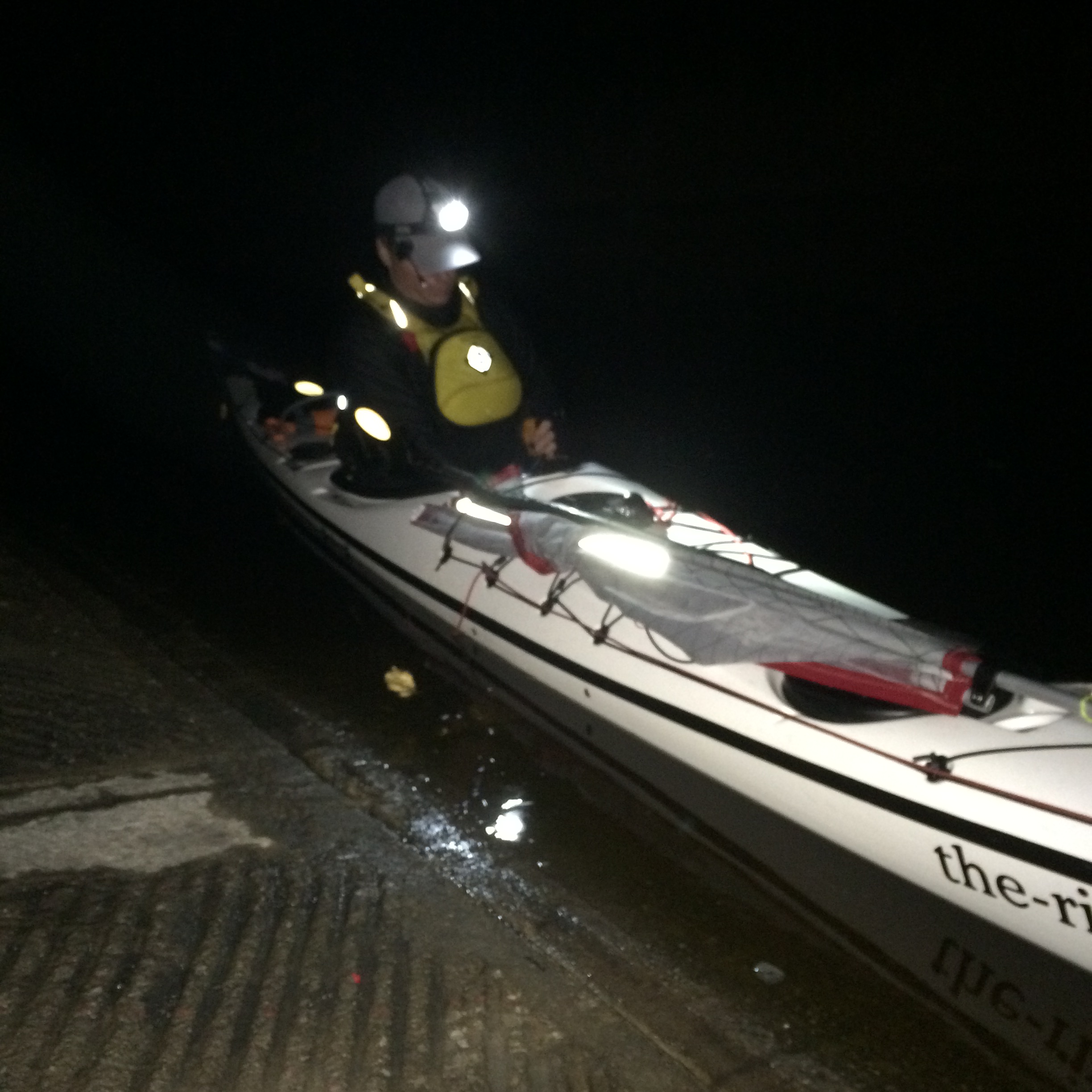
Set for night kayaking
Knowing when to call it for the night.
Now that I had exited Thorofare and started north through West Throrfare Bay I got to encounter that North wind again and the chop from a good long fetch in the dark. Knowing I had miles to go I bent to the task but with slow headway and fatigue catching up with me rest became overpoweringly appealing to me. 45 degrees to the right and 20 minutes later brought me to the southern outer edge of Tump Point. This flattened grassy point is only a couple inches off the water but it was solid, not marshy so I hauled up and set about making some soup and fortified it with some quinoa. Very good 10pm dinner. Of course warm food makes for need of nap. With the kayak as a windbreak, the unfurled Crazy Creek chair and reflective sport blanket under me climbing into the AMK Escape Bivy was just the thing to recharge. Note for the future though, take the time to change into camp clothes as Kokatat Surfskin is great to paddle in but make for a special kinda clammy after a couple hours. Surprisingly I got 3 hours of sleep and after moving around a bit pulling gear together the cold claminess had diminished and was ready to tackle the slog north.
Lessons learned for paddling on a bearing at night
Moving off Tump Point into the black, chop and wind knowing I needed to keep a heading to the NE my perceptive awareness became focused on my compass, GPS and a bit off the bow looking for the next creating wave. Turns out this is not how to keep on a bearing while paddling as my sinusoidal track proved. Then it struck me, “I’ve got ranges, the stars!” (Still that descent into stupidity thing) NE corresponded perfectly to the tail of Ursa Major and my perspective moved up along with my spirits. So little light made for a glorious celestial display punctuated about every 5 minutes with a shooting star descending right through the Big Dipper. Made the wind and chop just not seem so arduous. On the final turn eastward toward CP1 a bit of sail made for an easy cruise into, which house was it? Ah the one with the bright LED light waving at me! Thanks DancesWithWaves!
Civilized roughing it at CP1. Thank you DancesWithWaves for the hospitality! Being able to grab a hot shower and a bed for an extra power nap felt great.
Just not hip to West and Long Bay reaches.
After futzing with gear a bit I pushed off and OK’d my SPOT at 7:30am. BB launched first and was starting to catch wind and shortly after my launch Ridge Runner put on and passed me before rounding Western Point. A very light breeze in CP1 would lead to solid wind from the North the whole way down West and Long Bay. As soon as I raised the mast on the kayak sail I immediately felt it in the muscles of my left hip complain from their Core (Sound) workout yesterday. Once turned SW the wind gave a steady push and with a little paddle power made for 4.5+ mph easily. With sail pressure pushing over on the left I couldn’t stand being in the seat. A bit of a compromise I was able to come up with was to hold the paddle in a rudder position on the right side and take my foot off the left foot peg straightening out my leg. This allowed me to lean my body over the windward side a bit as a counter weight. Not complete relief but better. If I only thought to flip the boom over to starboard and adjust the shroud a bit. Ah, next time.
When GPS maps don’t have all the answers (Old Canal)
While Maptech charts show the Old Canal to Turnagain Bay Garmin does not. It’s just a bit confusing trying to mesh what you’re looking at vs. a chart, paper or electronic, which may or may not show the most current weather modified lowland occluded entrance to the Canal. When you’re 2′ tall in a kayak grass looks all the same and it’s easy to miss an opening.
Whitecaps for as far as the eye can see and how to nap in an EZ Bake Oven
Coming out of the calm respite, which was the Old Canal, the North Wind was back. To get to the head of Turnagain Bay was simply a matter of head down, stow the sail, dig in and do it. At the west side of the end of the bay the charts show a little hook of land. This has actually turned into a sandy little island which made for a great spot to land, stretch and survey. What I could see was and entire Nuese River filled with cresting whitecaps. “No way!”, I thought. My attitude went to pot as I thought about 16 miles of waves mashing me from the side. Well, I wasn’t going to push that for the moment. I called my Race Team Support and arranged to meet at South Creek where I was going make the determination of continuing or not. Feeling lousy and shivering a bit from the wind I decided I was low on food so had a sandwich, set up my Crazy Creek Chair, put on a hooded paddle jacket and wrapped my legs in the one sided reflective space blanket, I used the night before, and nodded off facing the sunshine on my protected spit of sand. I got quite toasty quickly in my solar powered EZ Bake Oven. When I opened my eyes, 45 min. had passed. I certainly felt better than when I first viewed the scene of whitewater. Chief was right. A bit of food and some rest can do wonders. In fact the wind had died considerably, almost all the whitecaps were gone. I was warm enough I could switch out of the Surfskin shirt and use a SunCore shirt onto of the base layer. Perhaps 16 miles wouldn’t be so bad. I would paddle to South Creek and call it when I got there.
Making the turn into South Creek I had to flip a coin. In the 1.5 hours it took me to go that distance I felt I would need to rest up again for to make the next half of the remaining 9 miles so I needed to take a number of things into consideration.
- I would be making the crossing at dusk and likely on fumes.
- Would the weather change again?
- Being that I have a physical job, in the mundane world, would I hurt myself?
- I really want to complete the goal I set out to do.
As I paused outside of South Creek pondering these things and coming up with equal answers I decided to flip a quarter, left over from my Davis Ferry Ice Cream Stop. Heads I ‘d continue on, Tails I’d call it. The flashing coin arced it’s trajectory to determining my course, straight into the water. Kerplunk! Some things are ultimately for you to decide and not an outside agency or device. In adding my two bits of treasure to Blackbeards hoard I took that to equal Tails, I’d call it.
Lessons learned
- At 13 hours of on water time, start to look for camp locations. At 15 hours stopping will become mandatory or errors by fatigue will increase.
- Alternate the boom to even up sail pressure on both sides of the pelvis. I have a simple water bottle counterweight idea I’m going to play with as well. I’ll see how that works.
- Make a plastic plate that can attached to the deck of the sprayskirt, even if it becomes a dedicated skirt, so as to mount the GPS to. Mounting it on deck blocks the compass which is much easier to keep an eye on for keeping a heading. Garmin might have a Heading indicator mode, if so that could solve a bit of fabrication.
- Bring a spare bite valve for the hydration tube. I forgot to mention that on day two the valve gave up and took some extra work to drink.
- When camping, use camp clothes. Get outta the wet stuff.
- I’m sure I’ll ponder a few more things before 2016 Okoumefest.

Fascinating. When following various SPOTs, I’ve always wondered what is actually going on. EZ Bake Oven? Now I’m really intrigued.
Wow. Pound nets that jump out of the darkness to ensnare your boat, endless squadrons of tiny winged vampires trying to suck your blood, currents, winds, waves, and things lurking beneath the water looking for an easy meal. Sounds more like an epsiode of “Survival.” Well done, well written, and I know I’ll think of that great line about descent into stupidity during my next downward trajectory – most likely the next time I paddle.